 |
 |
 |
 |
 |
 |
|
|
|||||||
| The day is blossoming into unbridled glory as the sun finally battles its way from behind the clouds. It started rainy and miserable. Actually, it started cloudless. Then by the time camp had been struck, thunder rumbled overhead. It was incredible. Clouds just boiled out of the east and covered the sun moments before we were to get our sunrise... It's now about 8:00 PM. We've made camp on a rocky slope about 2 miles shy of Forester Pass. It's been an extraordinary day. | |||||||
| 8/2- near Forester Pass 6:45 pm- What a day! It started out clear and just before the sun was to crest the ridge, a small cloud appeared. Within 30 minutes the sky was overcast and we could hear thunder. We set off at 7:40 uphill, of course. We stopped to put on rain gear, took it off later, then on again. | |||||||
|
|||||||
| The first teensy entry in this day's section was written at Sandy Meadow, just as the day turned an incredible shade of marvelous. We tromped down the descent to Wallace Creek. The clouds had vanished. The sky was tremendous. Mom and I had a quick bite at the creek and started up the opposite side of the canyon--a simple jag across its face to more mellow terrain above. The slog to Bighorn Plateau became difficult as a new batch of rain clouds boiled up over the eastern crest and began to drizzle. Between the weight of her pack, the need to dig raingear out of its depths and the uphill battle, Mom was soon grousing with verve. There was nothing I could do to help, so I just kept silent company as we pushed up through the nasty weather to the plateau. It was very sad the weather was so foul. The view from the plateau would have been spectacular. Wide and flat, with Tawny Point to the east, a serene, grass-embraced lake to the west and all around us, jagged peaks. But now those peaks were slate gray. Thunder rolled overhead and we were both acutely aware that we were the tallest objects for hundreds of yards in every direction. So we hurried across the plateau toward a stand of foxtail pines and the descent to Tyndall Creek beyond. The rain increased. We took shelter beneath a rather tall tree and stood there while the rain turned to hail. We were prepared to stand there even longer but a thunderclap broke directly overhead. We moved on. | |||||||
|
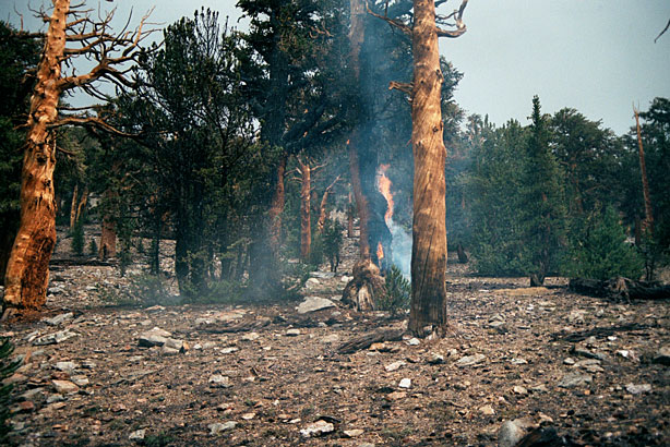
I crossed Wallace and Wright Creeks on boulders with no problem. Yea! On the moraines up to Big Horn Plateau I had a loss of energy but I recovered. BHP was neat but there were clouds everywhere and then it started to rain, then hail. We stopped briefly under 2 trees and Will got film out to take pictures of a burning tree that had been struck by lightning. Then lightning and a loud clap of thunder overhead and we were outta there! On down to Tyndall Creek. |
|||||||
|
Our next stop was by the burning tree. There aren't many things that will make me take off my pack in the driving hail, dig around for a fresh roll of film to replace the one I'd finished at Sandy Meadow and with freezing fingers, snap off a couple photos. But the burning tree was one of them. A lightning bolt had apparently taken a fancy to a burly foxtail about 25 yards upslope from the trail. The thing was ablaze. It must have just happened. So I hurried upslope with the camera and clicked away. And just then, the sun came out. So I have photographs of a tree burning in a hailstorm and a patch of sunlight. Wild. |
|||||||
Four shots of the burning tree. This thing
burned for days. The Ranger finally put up signs |
|||||||
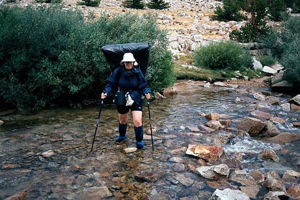
| The sun went away pretty quickly, but we were energized by its brief appearance. We made the wet descent to Tyndall Creek, forded it (it wasn't that cold) and found a campsite just on its opposite bank. We refrained from pitching the tent. Instead, we cooked dinner, rested up, dried off--the sun came out for a while--and repacked to get a little closer to Forester Pass, which is our next big challenge. In the end, we got closer than we'd imagined, thus the campsite deep in marmot territory. But I think it'll pay off, for rain is on deck for tomorrow and the sooner we get over the damned thing, the better. | |||||||
|
|||||||
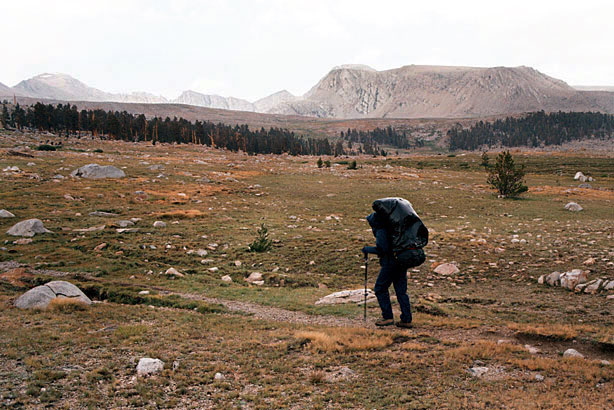
| We stopped at a campsite there and made corn pasta with garlic, green peppers, mushrooms, cheese and milk. Mmmm. Also miso. Then we out the gear back on and hiked up the trail toward Forester. We passed the Lake South America Trail soon, so we went on farther- to a high barren plateau. Camped high, no water. It's raining now. There's a view of Mt. Whitney. Thoughts about Big Horn Plateau: the bad weather was a bummer. I'm sure it's a special place. I'm feeling better about my conditioning. As the pack gets lighter, I do better. Will is now carrying tent poles and most of the food. I only got exhausted once. I do wish the weather would get better- we've had heat, rain, hail, thunder. | |||||||
Three shots of Chris headed towards Forester Pass. The
basin leading to Shepherd Pass |
|||||||
| So now we're in the tent. No shower, no bath, no toothbrush even. We're just ready to hit it and wake up tomorrow for the assault. The rain has stopped. The sun is down. I wonder...if I were to push my head out of this tent, would I see stars? | |||||||
|
Deep in marmot territory |
|||||||


